

SiriusXM has partnered with Furuno and Simrad on Fish Mapping, a subscription-based service that offers a range of information to assist anglers in improving their chances of success during offshore fishing trips.
Fish Mapping utilizes a constellation of satellites to gather data and interpret it to predict the best fishing areas.
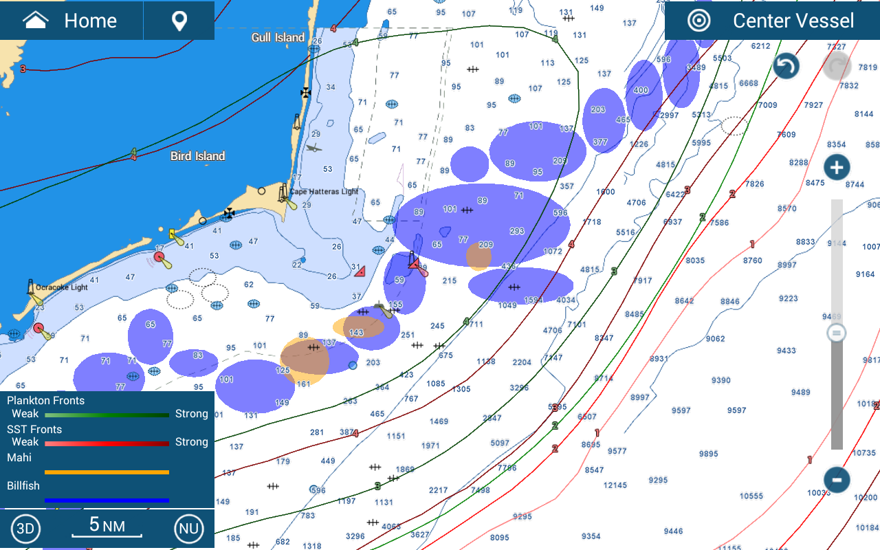
“We’re excited to bring the amazing capabilities of SiriusXM Fish Mapping to our TZtouch3 customers,” Furuno USA vice president of sales, marketing & product planning Dean Kurutz said in a statement. “With the advanced data provided by Fish Mapping, captains will have the ability to locate ideal fishing grounds by targeting specific species and sea conditions, maximizing their time on the water and helping save time and fuel.”
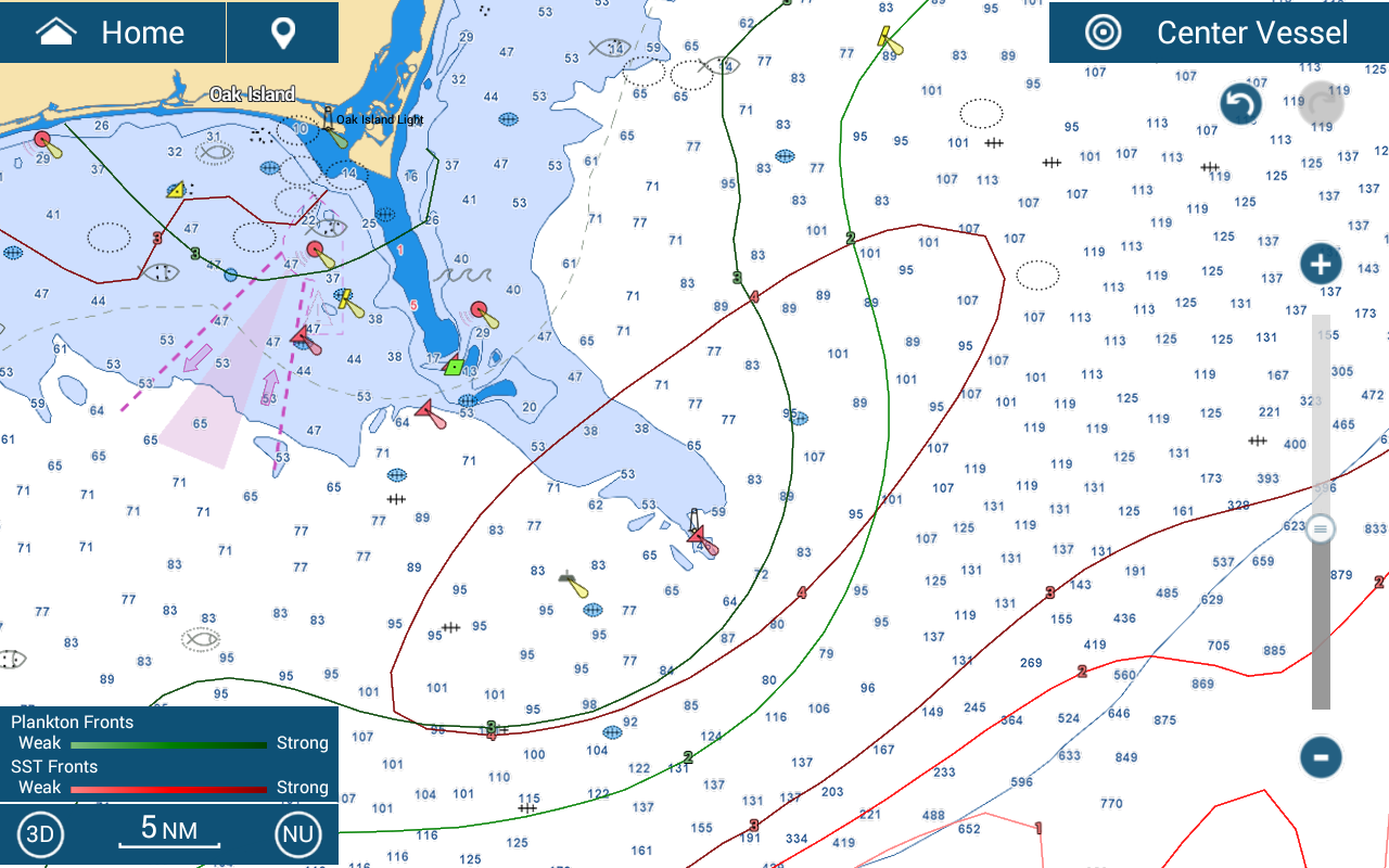
For $100 a month, anglers can bundle Fish Mapping, which includes SiriusXM’s Marine Offshore Weather package. Seasonal fishermen can suspend service for up to six months per year without a reactivation charge.
Fish Mapping provides eight features to help anglers catch fish, from ooceanographer-sourced Fishing Recommendations to Sea Surface Height Anomalies, Temperature Contour Lines and Fronts to Sub-Surface Water Temperatures up to 30 meters beneath the surface and Plankton Concentrations and Fronts.
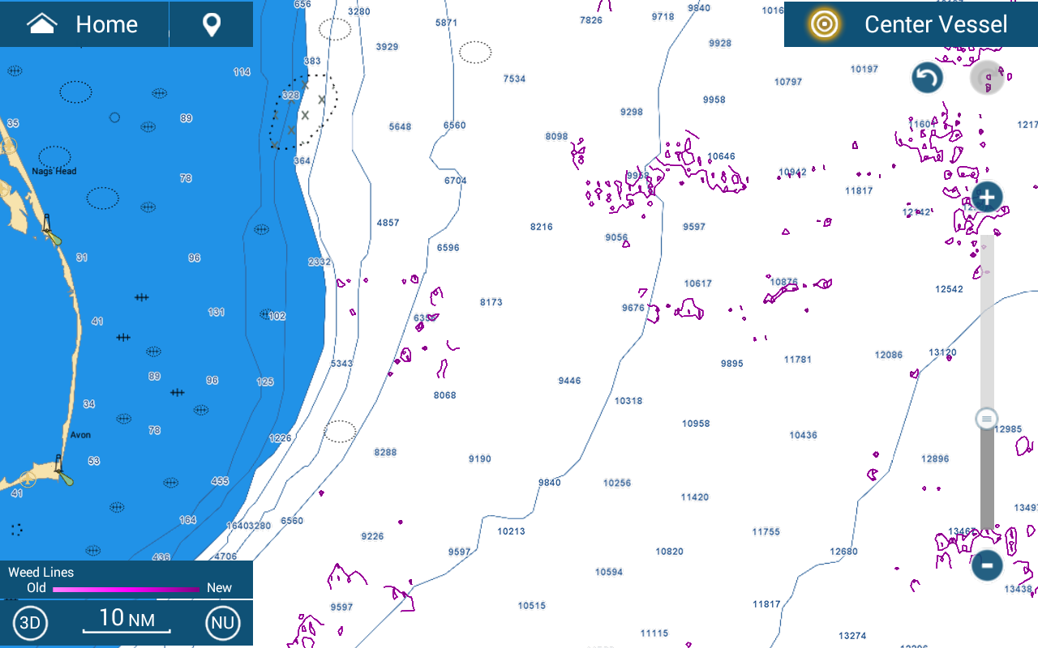
In a separate statement, Simrad senior vice president of project management and project director Stephen Thomas said: “Saltwater anglers and charter captains have long relied on various information sources to maximize their chances of fishing success on the water, and SiriusXM’s Fish Mapping provides a comprehensive, effective and easy-to-interpret set of features that makes getting to areas with the highest probability of success easier than ever before.”
Click here for more information on the suite of Fish Mapping features.